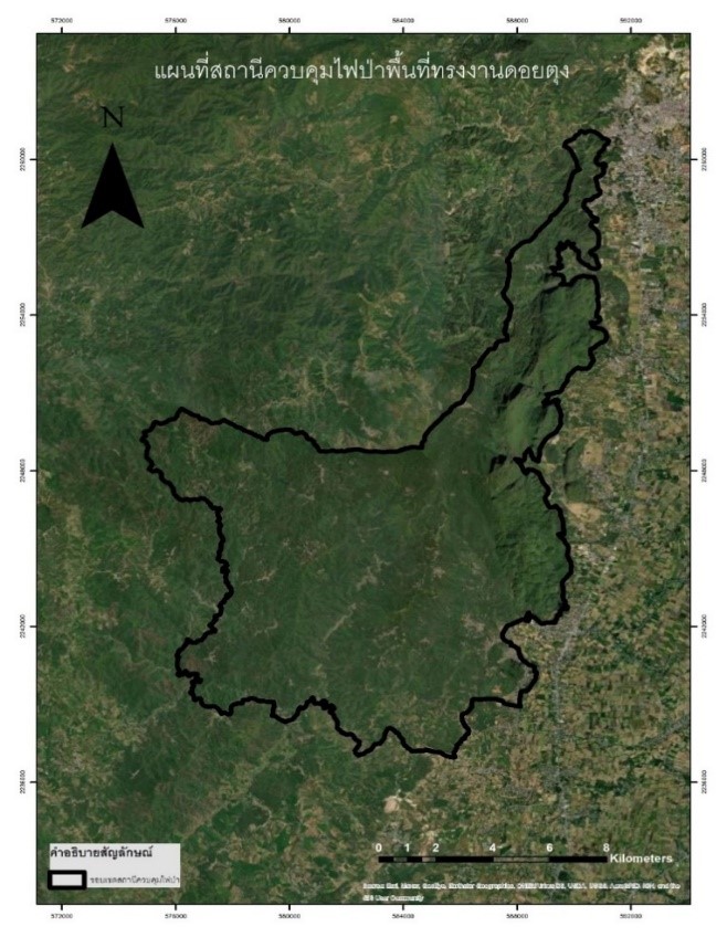
Estimation of Forest Fire Severity and Post-fire Vegetation Recovery Using Landsat 8 OLI Imagery Data in Royal Initiative Project Area, Forest Fire Control Station, Doi Tung, Chiang Rai
Keywords:
Forest fire, Google earth engine, Difference Normalized Burn Ratio, Burn Recovery Ratio, Landsat 8 imageryAbstract
Wildfires are a sudden form of damage that affect humans and the environment. The application of remote sensing technology in forestry is widely used, which helps to estimate the severity of forest fires and post-fire vegetation recovery. The purpose of this study was to assess the severity of forest fires and post-fire vegetation recovery on the Google Earth Engine platform from Landsat 8 surface reflectance satellite images during the years 2015 to 2021 using the Normalized Burn Ratio (NBR) index to identify the forest fire areas, and the Difference Normalized Burn Ratio (dNBR) index to assess the severity of forest fires. Then, post-fire vegetation recovery was assessed using the burn recovery ratio (BRR). It was found that most levels of the forest fire severity in this study area were unburned which was 33.01% to 88.84% of the area, and low severity was 6.91% to 61.46% of the area. At the part of the post-fire vegetation recovery level, most of the vegetation recovery level was very poor. In addition, the results of burn severity analysis (dNBR) with the results of vegetation recovery level (BRR) in 2021 were analyzed to calculate the percentage of vegetation recovery per area. It was found that the post-fire vegetation recovery was mostly partially complete level. The results of this study can be used to plan and prevent forest fires in recurring or vulnerable forest fire areas for increasing the rate of regeneration of vegetation.
References
กลุ่มงานจัดการสิ่งแวดล้อมธรรมชาติ. (2022). ดอยตุง. จาก สำนักงานนโยบายและแผนทรัพยากรธรรมชาติและสิ่งแวดล้อม: https://naturalsite.onep.go.th/site/detail/22
จตุรงค์ สมอาจ, วรวิทย์ จิตรสุขขา, สาวิตรี รตโนภาส สุวรรณลี และ สุรีรัตน์ คนเพียร. (2019). การตรวจวัดพื้นที่ฟื้นฟูไฟป่าเขตอนุรักษ์ในพื้นที่จังหวัดเลย. Thai Science and Technology Journal (TSTJ).
ณกร วัฒนกิจ และ รณกรณ์ งิ้วพรม. (2018). การประเมินการฟื้นฟูสภาพป่าหลังการเกิดไฟป่าโดยการใช้เทคนิคการรับรู้ระยะไกล. การประชุมวิชาการ “ทรัพยากรธรรมชาติ สารสนเทศภูมิศาสตร์ และสิ่งแวดล้อม นเรศวร ครั้งที่ 3.
พลาย ภิรมย์. (2020). ไฟป่าและอนาคตวิกฤตที่เกินควบคุม. WWF & Boston Consulting Group: Fires, Forests, and the Future.
ศิริภัทร เอี่ยมละออ. (2015). การวิเคราะห์ไฟป่าที่ส่งผลกระทบต่อการท่องเที่ยวในเขตอุทยานแห่งชาติน้ำหนาว. วิทยานิพนธ์ ระดับปริญญาตรี ภาควิชาทรัพยากรธรรมชาติและสิ่งแวดล้อม คณะเกษตรศาสตร์ทรัพยากรธรรมชาติและสิ่งแวดล้อม มหาวิทยาลัยนเรศวร.
สมชาย โกมลคงอย. (2019). การใช้เทคโนโลยีภูมิสารสนเทศ เพื่อจำแนกพื้นที่เสี่ยงต่อการเกิดไฟป่า ในพื้นที่ป่าอนุรักษ์ภาคเหนือ. สำนักป้องกัน ปราบปราม และควบคุมไฟป่า. กรมอุทยานแห่งชาติ สัตว์ป่า และพันธุ์พืช กระทรวงทรัพยากรธรรมชาติ และสิ่งแวดล้อม.
Chao-Yuan Lin Chuphan Chompuchan. (2017). Ecological Indicators. 196-206.
Chou, W.-C., Lin, W.-T., Lin, C.-Y.. (2009). Vegetation recovery patterns assessment atlandslides caused by catastrophic earthquake: a case study in central Taiwan. Environ. Monit, 152, 245–257. http://dx.doi.org/10.1007/s10661-008-0312-8
Google Earth Engine. (2020). A planetary-scale platform for Earth science data & analysis. Retrieved on July 15, 2021, from official website: https://earthengine.google.com
Key, C.H., Benson, N.C.. (2006). Landscape assessment (LA): sampling and analysis methods. In: Lutes, D.C., Keane, R.E., Caratti, J.F., Key, C.H., Benson, N.C., Sutherland, S., Gangi, L.G. (Eds.), FIREMON: Fire Effects Monitoring and Inventory System (General Technical Report RMRS-GTR-164-CD). Rocky Mountains Research Station, USDA Forest Service, pp. LA1–LA55.
Lin, W.-T., Lin, C.-Y., Chou, W.-C., 2006. Assessment of vegetation recovery and soilerosion at landslides caused by a catastrophic earthquake: a case study in CentralTaiwan. Ecol, 28, 79–89. http://dx.doi.org/10.1016/j.ecoleng.2006.04.005
Schepers, L., Haest, B., Veraverbeke, S., Spanhove, T., Vanden Borre, J., Goossens, R., (2014). Burned Area Detection and Burn Severity Assessment of a Heathland Fire in Belgium Using Airborne Imaging Spectroscopy (APEX). MDPI, 6(3), 1803-1826
Veraverbeke, S., Lhermitte, S., Verstraeten, W.W., Goossens, R., 2011. A time-integrated MODIS burn severity assessment using the multi-temporal differenced normalized burn ratio (dNBRMT). Int. J. Appl. Earth Obs. Geoinf. 13, 52–58. http://dx.doi.org/10.1016/j.jag.2010.06.006