Application of Unmanned Aerial Vehicle Imageries for Evaluating Green Spaces and Tree Canopy Coverages within University of Phayao
Keywords:
Green Space Mapping, Unmanned Aerial Vehicle Imagery, Tree Canopy Coverage EvaluationAbstract
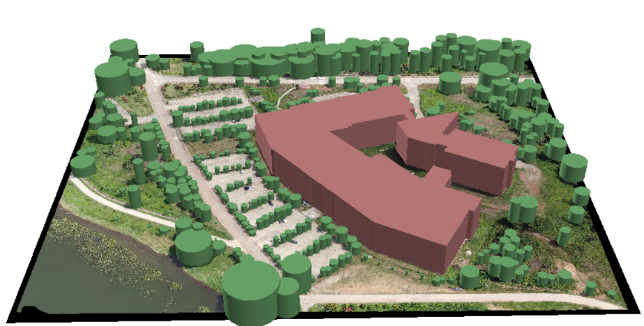
The objective of this study was to evaluate green spaces and tree canopy coverages using unmanned aerial vehicle imagery around school of information and communication technology within University of Phayao. After taking photographs using DJI Phantom 4 Pro v2.0 with color RGB camera, multiple images were processed and mosaiced together by DroneDeploy. Map layers of green spaces and tree canopies were created using digitizing on-screen and visual interpretation. Later, ratio of green spaces per capita was calculated based on data from geographic information system. The result showed that there was 61.41% green space in the total study area (or 23.89 m2 per capita). The result showed also that the tree canopy coverage evaluation was possible and utilized as support data for green spaces management.
References
กองการเจ้าหน้าที่. (2565). สรุปอัตรากำลัง บุคลากร ของมหาวิทยาลัยพะเยา ปี 2563. มหาวิทยาลัยพะเยา. สืบค้นเมื่อ 30 มีนาคม 2565. สืบค้นจาก: http://www.personnel.up.ac.th/ContentRead.aspx?c=อัตรากำลัง
ไทยพีบีเอส. (2565). คนกรุงเทพฯ มีพื้นที่สีเขียวไม่เพียงพอจริงหรือ?. สืบค้นวันที่ 10 ธันวาคม 2565. สืบค้นจาก: https://thevisual.thaipbs.or.th/bangkok-green-space/main/
ปุณยนุช รุธิรโก. (2557). การประเมินคุณภาพและแนวทางการจัดการพื้นที่สีเขียวนันทนาการในเขตเทศบาลนครหาดใหญ่ และเทศบาลเมืองคอหงส์ อำเภอหาดใหญ่ จังหวัดสงขลา. ปรัชญาดุษฎีบัณฑิต. สงขลา: มหาวิทยาลัยสงขลานครินทร์.
พรพจน์ เพ็ญพาส. (2565). การสำรวจและจัดทำแผนที่ด้วยอากาศยานไร้คนขับ. กรมโยธาธิการและผังเมือง. สืบค้นวันที่ 10 ธันวาคม 2565. สืบค้นจาก: http://oldoffice.dpt.go.th/km/images/pdf/paper_km_6_63.pdf
ระบบบริการการศึกษา. (2565). จำนวนนิสิตในปัจจุบัน. มหาวิทยาลัยพะเยา. สืบค้นเมื่อ 30 มีนาคม 2565. สืบค้นจาก: https://reg.up.ac.th/content/all/information
วราลักษณ์ คงอ้วน และ พุฒพรรณี ศีตะจิตต์. (2554). การจัดการพื้นที่สีเขียวในสถาบันศึกษา: กรณีศึกษามหาวิทยาลัยธรรมศาสตร์ ศูนย์รังสิต. วารสารวิชาการคณะสถาปัตยกรรมศาสตร์ สจล, 13(2), 74-87.
ศุภกิจ พิทักษ์บ้านโจด. (2565, 3 มกราคม). พื้นที่สีเขียวในเมืองใหญ่. becommon. สืบค้นวันที่ 10 ธันวาคม 2565.
สืบค้นจาก: https://becommon.co/culture/green-bangkok/
สำนักข่าวอิศรา. (2565, 19 มีนาคม). ‘พื้นที่สีเขียว’ ดัชนีวัดความสุขคนกรุง ส่วน กทม.ยังห่างไกลจากคำว่า ‘เมืองสิ่งแวดล้อม’. สำนักข่าวอิศรา. สืบค้นวันที่ 10 ธันวาคม 2565. สืบค้นจาก: https://www.isranews.org/article/isranews-scoop/107414-isranews-246.html
สำนักงานนโยบายและแผนทรัพยากรธรรมชาติและสิ่งแวดล้อม. (2565). การจัดการพื้นที่สีเขียวชุมชนเมืองอย่างยั่งยืน. สืบค้นวันที่ 10 ธันวาคม 2565. สืบค้นจาก: http://www.onep.go.th/ebook/eurban/eurban-publication-07.pdf
สำนักงานนโยบายและแผนทรัพยากรธรรมชาติและสิ่งแวดล้อม. (2565). แผนปฎิบัติการเชิงนโยบายด้านการจัดการพื้นที่สีเขียวชุมชนเมืองอย่างยั่งยืน. สืบค้นวันที่ 10 ธันวาคม 2565. สืบค้นจาก:http://www.onep.go.th/ebook/eurban/eurban-publication-06.pdf
สำนักงานนโยบายและแผนทรัพยากรธรรมชาติและสิ่งแวดล้อม. (2565). พื้นที่สีเขียว. สืบค้นวันที่ 10 ธันวาคม 2565. สืบค้นจาก: https://www.onep.go.th/พื้นที่สีเขียว/
สินีนาถ ศุกลรัตนเมธี. (2562, 19 กรกฎาคม). พื้นที่สีเขียวในเมือง ต้องมีการวางแผนเชิงรุก 2022. มติชนออนไลน์. สืบค้นวันที่ 10 ธันวาคม 2565. สืบค้นจาก: https://www.matichon.co.th/article/news_1585145
Russo A, and Cirella G. T. (2018). Modern Compact Cities: How Much Greenery Do We Need?, Int J Environ Res Public Health, 15(10), 1-15.