Analysis of the Population and Areas Affected by Flooding Using Open Data
Keywords:
Flood, Open-Source Software, Sentinel-1A, Land ScanAbstract
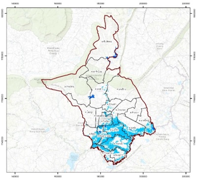
The recent floods in Thailand have caused damage to people and the economy. The government will have remedial measures to help victims in various areas by surveying the number of impacts that occur to the victims. However, this process will create gaps between flood impact surveying. Therefore, the researcher developed flood areas assessment using open data and open-source software to assess flooded areas from Sentinel-1A data compared with flood data from the Geo-Informatics and Space Technology Development Agency (GISTDA). And analyze the number of people affected by flooding in the area. As a result, it was found that the affected area of flooding was 387,471.56 rai. While the error value from the flooded area of the GISTDA was 6.83%, the accuracy was 93.17%, and the affected population of the sample area was 69,644. These results complement the disaster-affected area (flood) announcement but can specify the extent of the quantitative and spatial flooding. It can be used as crucial information for declaring disaster-affected areas (floods), considering payment of compensation, and planning to manage floods to be more effective in the future.
References
สถาบันสารสนเทศทรัพยากรน้ำ (องค์การมหาชน). (2565). บันทึกเหตุการณ์มหาอุทกภัยปี 2554.
สืบค้นจากhttp://tiwrmdev.hii.or.th/current/flood54.html
สำนักงานป้องกันและบรรเทาสาธารณภัยจังหวัดชัยภูมิ. (2564). ประกาศเขตพื้นที่ประสบภัยปีงบประมาณ พ.ศ.2564 ประกาศกองอำนวยการป้องกันและบรรเทาสาธารณภัยจังหวัดชัยภูมิ เรื่องประกาศเขตพื้นที่ประสบสาธารณภัย (อุทกภัย) จำนวน 16 อำเภอ. สืบค้นจาก http://cpm.disaster.go.th/cmsdetail.cyp-6.110/52449/inner_2775/5252.1/
ผู้จัดการออนไลน์. (2564, 6 ตุลาคม). มท.ให้ค่าซ่อมบ้านหลังละเกือบ 5 หมื่น ทุ่มงบช่วยน้ำท่วมทุกครัวเรือน. สืบค้นจาก https://mgronline.com/specialscoop/detail/9640000098851
Cole, T. J., & Altman, D. G. (2017). Statistics Notes: What is a percentage difference?. Bmj, 358.
Environmental Systems Research Institute (ESRI). (2022). Reclassify (Spatial Analyst). Retrieved from https://pro.arcgis.com/en/pro-app/2.8/tool-reference/spatial-analyst/reclassify.htm.
European Space Agency (ESA). (2022). Copernicus Open Access Hub. Retrieved from https://scihub.copernicus.eu/dhus/#/home.
Geo-Informatics and Space Technology Development Agency (GISTDA). (2022). Thai flood Monitoring System. Retrieved from https://flood.gistda.or.th.
Global Land Analysis and Discovery Lab. (2022). Estimating Tree Cover Area and Change Using Sample-based Analysis. Retrieved from: https://glad.umd.edu/Potapov/Madagascar_2017/Documents/03_GLAD_ Sampling.pdf.
Heinz, G., Martin, S., Roland, W., Mathias, S., Birgit, K., & Ursula, S. (2015). Remote sensing based two-stage sampling for accuracy assessment and area estimation of land cover changes. Remote sensing, 7(9), 11992-12008.
Oak Ridge National Laboratory (ORNL). (2022). LandScan Datasets. Retrieved from https://landscan.ornl.gov/ landscan-datasets.
Rubel, O., Lukin, V., Rubel, A., & Egiazarian, K. (2020). Prediction of Lee filter performance for Sentinel-1 SAR images. Electronic Imaging, 2020(9), 371-1.
TNN Online. (2564, 22 ธันวาคม). 10 ข่าวเด่นแห่งปี ลำดับที่ 1/10 บันทึกเหตุการณ์ "น้ำท่วมใหญ่" 2564 หวนซ้ำรอยในรอบ 10 ปี. สืบค้นจาก https://www.tnnthailand.com/news/local/99775/.