Water Feature Extraction using Google Earth Engine
Keywords:
Google Erath Engine (GEE), Normalized Difference Water Index (NDWI), Feature ExtractionAbstract
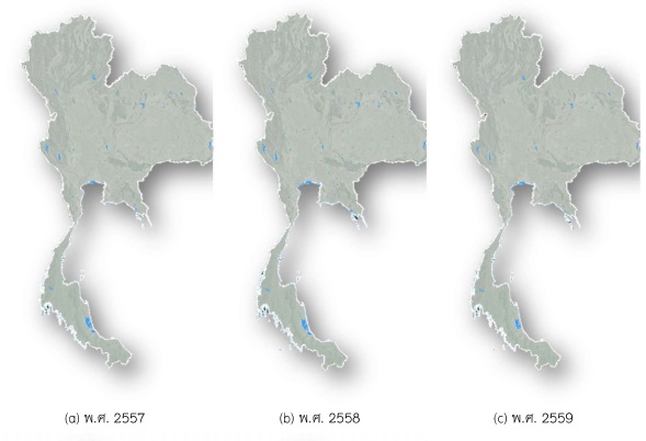
The research aims to study and apply Google Earth Engine (GEE) to extract waterbody feature from satellite images in order to monitor changes in waterbodies in Thailand, during 2014 to 2018 by using the satellite images of Landsat 8 (in summer period of Thailand). In terms of the Normalized Difference Water Index (NDWI) dataset in Google Earth Engine platform and threshold value which used to extract the waterbody derived from the standard value in referenced research and the computed value from the training point, it shows that the water body areas in Thailand during the year 2014 to 2018 are 15,434.28, 13,706.93, 9,634.60, 13,890.91, 14,924.75 Square kilometer (km2) and 17,144.93, 10,188.76, 12,800.49, 9,951.64, and 11,037.56 Square kilometer (km2) respectively. According to the findings of the study, Google Earth Engine is now free available for non-commercial use and educational purpose and provide many satellite images from over the past 20 years.Furthermore, Google Earth Engine and their services can be store and analyze a huge of data on Google’s cloud platform without requirement to download the data for analyst and processing in personal computer.