The Impacts of Land Use and Land Cover Change on Ecosystem Service Values at Lam Takhong Watershed, Thailand
Keywords:
Binary logistic regression analysis, CLUE-S model, Ecosystem service value, Lam Takhong watershed, Simple benefit transfer methodAbstract
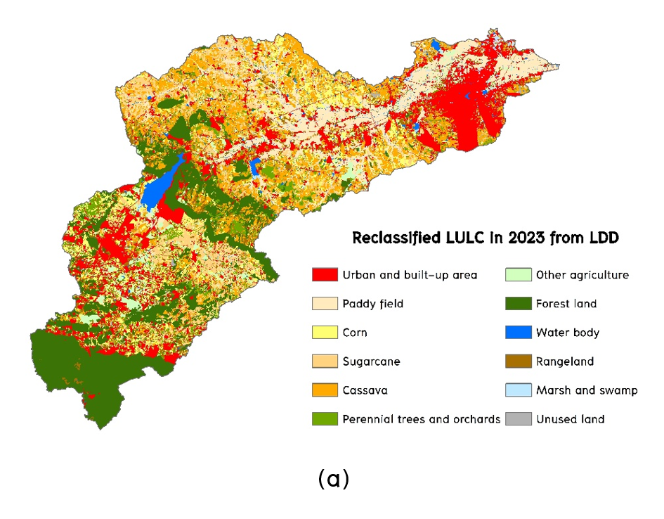
Understanding the driving factors of land use and land cover (LULC) change, predicting LULC change, and assessing the effects of LULC change on future ecosystem service values are crucial for land managers and land use planners to mitigate their impacts. This research aims to identify driving factors on LULC change and apply them to predict LULC changes using the CLUE-S model for evaluating ecosystem service value and change in the Lam Takhong watershed. As a result, the most significant driving factors on LULC change were elevation, annual rainfall, and irrigation area. The predicted LULC data between 2024 and 2039 indicated an increase in urban and built-up areas, sugarcane, perennial trees and orchards, other agricultural areas, water bodies, and unused land. Conversely, there were decreases in paddy fields, corn, cassava, forest land, rangeland, and marsh and swamp. The total ecosystem service value is expected to decrease continuously between 2023 and 2039. By considering ecosystem service value by its function, gas regulation, climate regulation, soil formation, biodiversity protection, food production, and raw material functions are expected to decrease marginally from 2023 to 2039. Still, waste treatment, water supply, recreation and culture functions will be slightly increasing in the future. In conclusion, LULC change affects the value of ecosystem services in each category and function within the Lam Takhong watershed, particularly through the conversion of paddy fields and forest land into other LULC types in the future. Therefore, the Government should establish specific policies or interventions to prevent land use and land cover change in the Lam Takhong watershed.
References
Allan, A., Soltani, A., Abdi, M. H., and Zarei, M. (2022). Driving forces behind land use and land cover change: A systematic and bibliometric review. Land, 11(8), 1222. Form https://doi.org/10.3390/land11081222.
Anderson, J. R., Hardy, E. E., Roach, J. T., and Witmer, R. E. (1976). A land use and land cover classification system for use with remote sensor data. Professional paper 964. U.S. Geological Survey. Form https://doi.org/10.3133/pp964.
Apan, A., Raine, S. R. and Paterson, M. S. (2000). Image analysis techniques for assessing landscape structural change: A case study of the Lockyer Valley catchment, Queensland. In Proceedings of the 10th Australasian Remote Sensing and Photogrammetry Conference 2000 (pp. 438-455). Canberra: CSIRO Land and Water.
Costanza, R., De Groot, R., Farber, S., Grasso, M., Hannon, B., Limburg, K., Naeem, S., V., R., Paruelo, J., Raskin, R. G., & Sutton, P. (1997). The value of the world’s ecosystem services and natural capital. Nature, 387(6630), 253-260. Form https://doi.org/10.1038/387253a0.
Fitzpatrick-Lins, K. (1981). Comparison of sampling procedures and data analysis for a land-use and land-cover map. Photogrammetric Engineering and Remote Sensing, 47(3), 343–351.
Hosmer, D., Lemeshow, S., and Sturdivant, R. (2013). Applied Logistic Regression (3rd edition). John Wiley & Sons.
Jensen, J. R. (2015). Introductory digital image processing: a remote sensing perspective (4th edition). Pearson Education: Inc.
Karki, J., Kumar, P., Baniya, B., and Robert, S. (2022). Estimation of land use based ecosystem service values and its response to climate change in Nepal. Applied Ecology and Environmental Sciences, 10, 730-737. Form https://doi.org/10.12691/aees-10-11-1.
Karki, S., Thandar, A. M., Uddin, K., Tun, S., Aye, W. M., Aryal, K., Chettri, N. (2018). Impact of land use land cover change on ecosystem services: a comparative analysis on observed data and people’s perception in Inle Lake, Myanmar. Environmental Systems Research, 7(1), 25. Form https://doi.org/10.1186/s40068-018-0128-7.
Kindu, M., Schneider, T., Teketay, D., and Knoke, T. (2016). Changes of ecosystem service values in response to land use/land cover dynamics in Munessa–Shashemene landscape of the Ethiopian highlands. Science of The Total Environment, 547, 137-147. Form https://doi.org/10.1016/j.scitotenv.2015.12.127.
Kulsoontornrat, J., and Ongsomwang, S. (2021). Suitable land-use and land-cover allocation scenarios to minimize sediment and nutrient loads into Kwan Phayao, Upper Ing Watershed, Thailand. Applied Sciences, 11(21), 10430. Form https://doi.org/10.3390/ app112110430.
Leh, M. D. K., Matlock, M. D., Cummings, E. C., and Nalley, L. L. (2013). Quantifying and mapping multiple ecosystem services change in West Africa. Agriculture, Ecosystems & Environment, 165, 6-18. Form https://doi.org/10.1016/j.agee.2012.12.001.
Liang, X., Liu, X., Chen, G., Leng, J., Wen, Y., and Chen, G. (2020). Coupling fuzzy clustering and cellular automata based on local maxima of development potential to model urban emergence and expansion in economic development zones. International Journal of Geographical Information Science, 34(10), 1930-1952. Form https://doi.org/10.1080/13658816.2020.1725016
Liu, G., Jin, Q., Li, J., Li, L., He, C., Huang, Y., and Yao, Y. (2017). Policy factors impact analysis based on remote sensing data and the CLUE-S model in the Lijiang River Basin, China. Catena. 158, 286-297. Form https://doi.org/10.1016/j.catena.2017.07.003.
Malczewski, J. (1999). GIS and multicriteria decision analysis. John Wiley & Sons.
Mamat, A., Halik, Ü., and Rouzi, A. (2018). Variations of ecosystem service value in response to land-use change in the Kashgar Region, Northwest China. Sustainability, 10(1), 200. Form https://doi.org/10.3390/su10010200.
Mamat, A., Saydi, M., Wang, J., Pang, Z., Long, X., Zhang, X., Halmurat, G., and Yisimayili, A. (2024). Evolution and driving forces of ecological service value in response to land use change in Tarim Basin, Northwest China. Remote Sensing, 16(13), 2311. Form https://doi.org/10.3390/rs16132311.
Mansoor, D. K. L., Marty, D. M., Eric, C. C., and Lanier, L. N. (2013). Quantifying and mapping multiple ecosystem services change in West Africa. Agriculture, Ecosystems and Environment, 165, 6-18. Form https://doi.org/10.1016/j.agee.2012.12.001.
Meyer, W. B., and Turner, B. L. (1996). Land-use/land-cover change: challenges for geographers. GeoJournal, 39(3), 237-240. Form https://doi.org/10.1007/BF00188373.
Millennium Ecosystem Assessment (2005) Ecosystems and human well-being: Synthesis. Island Press.
Munthali, M. G., Mustak, S., Adeola, A., Botai, J., Singh, S. K., and Davis, N. (2020). Modelling land use and land cover dynamics of Dedza district of Malawi using hybrid Cellular Automata and Markov model. Remote Sensing Applications: Society and Environment, 17, 100276. Form https://doi.org/10.1016/j.rsase.2019.100276.
Nelson, E., Mendoza, G., Regetz, J., Polasky, S., Tallis, H., Cameron, D., Chan, K. M., Daily, G. C., Goldstein, J., Kareiva, P. M., Lonsdorf, E., Naidoo, R., Ricketts, T. H., & Shaw, M. (2009). Modeling multiple ecosystem services, biodiversity conservation, commodity production, and tradeoffs at landscape scales. Frontiers in Ecology and the Environment, 7(1), 4-11. Form https://doi.org/10.1890/080023.
O’brien, R. M. (2007). A Caution Regarding Rules of Thumb for Variance Inflation Factors. Quality & Quantity, 41(5), 673-690. Form https://doi.org/10.1007/s11135-006-9018-6.
Ongsomwang, S., and Boonchoo, K. (2016). Integration of geospatial models for the allocation of deforestation hotspots and forest protection units. Suranaree Journal of Science and Technology, 23(3), 283-307.
Ongsomwang, S., and Iamchuen, N. (2015). Integration of geospatial models for optimum land use allocation in three different scenarios. Suranaree Journal of Science and Technology, 22(4), 377-396.
Ongsomwang, S., Pattanakiat, S., and Srisuwan, A. (2019). Impact of land use and land cover change on ecosystem service values: A case study of Khon Kaen City, Thailand: Environment and Natural Resources Journal, 17(4), 43-58. Form https://doi.org10.32526/ennrj.17.4.2019.30.
Phinyoyang, A. (2021). Optimized land use and land cover allocation for flood mitigation with goal programming, Mueang Chaiyaphum district, Chaiyaphum province, Thailand. (Doctoral dissertation), Suranaree University of Technology, Nakhon Ratchasima. (in Thai)
Phinyoyang, A., and Ongsomwang, S. (2021). Optimizing land use and land cover allocation for flood mitigation using land use change and hydrological models with goal programming, Chaiyaphum, Thailand. Land, 10(12), 1317. Form https://doi.org/10.3390/land10121317. (in Thai)
Pontius, Jr., R. G., and Schneider, M. (2001). Location bias in land use modeling. Agriculture, Ecosystems & Environment, 82(1-3), 163-177. Form https://doi.org/10.1016/S0167-8809(00)00231-1.
Puangkaew, N., and Ongsomwang, S. (2021). Remote sensing and geospatial models to simulate land use and land cover and estimate water supply and demand for water balancing in Phuket Island, Thailand. Applied Science, 11, 10553. Form https://doi.org/10.3390/app112210553.
Rogerson, P. (2006). Statistical methods for geography. SAGE Publications.
Rosenfield, G.H. and Fitzpatrick-Lins, K. (1986). A Coefficient of Agreement as a Measure of Thematic Classification Accuracy. Photogrammetric Engineering and Remote Sensing, 52(2), 223-227.
Roy, P.S. and Roy, A. (2010). Land use and land cover change in India: A remote sensing & GIS perspective. Journal of the Indian Institute of Science, 90(4), 489-502.
Ruamkaew, S. (2011). Assessment and prediction of agricultural and forest landscape sustainability in Lam Takhong watershed, Nakhon Ratchasima province, Thailand. (Doctoral dissertation), Suranaree University of Technology, Nakhon Ratchasima. (in Thai)
Shrestha, P. P., and Shrestha, K. J. (2017). Factors associated with crash severities in built-up areas along rural highways of Nevada: A case study of 11 towns. Journal of Traffic and Transportation Engineering (English Edition), 4(1), 96-102. Form https://doi.org/10.1016/j.jtte.2016.11.001.
Shuangao, W., Padmanaban, R., Mbanze, A. A., Silva, J. M. N., Shamsudeen, M., Cabral, P., and Campos, F. S. (2021). Using Satellite Image Fusion to Evaluate the Impact of Land Use Changes on Ecosystem Services and Their Economic Values. Remote Sensing, 13(5), 851. Form https://doi.org/10.3390/rs13050851.
Srichaichana, J., Trisurat, Y., and Ongsomwang, S. (2019). Land use and land cover scenarios for optimum water yield and sediment retention ecosystem services in Klong U-Tapao Watershed, Songkhla, Thailand. Sustainability, 11(10), 2895. Form https://doi.org/10.3390/su11102895.
Su, S., Xiao, R., Jiang, Z., and Zhang, Y. (2012). Characterizing landscape pattern and ecosystem service value changes for urbanization impacts at an eco-regional scale. Applied Geography, 34(1), 295–305. Form https://doi.org/10.1016/j.apgeog.2011.12.001.
Sun, X., Zhang, Y., Shen, Y., Randhir, T. O., and Cao, M. (2019). Exploring ecosystem services and scenario simulation in the headwaters of the Qiantang River watershed of China. Environmental Science and Pollution Research, 26, 34905–34923. Form https://doi.org/10.1007/s11356-019-06483-2.
Takada, T., Miyamoto, A., and Hasegawa, S. (2010). Derivation of a yearly transition probability matrix for land-use dynamics and its applications. Landscape Ecology, 25(4), 561-572. Form https://doi.org/10.1007/s10980-009-9433-x.
Tolessa, T., Senbeta, F., and Kidane, M. (2017). The impact of land use/land cover change on ecosystem services in the central highlands of Ethiopia. Ecosystem Services, 23, 47-54. Form https://doi.org/10.1016/j.ecoser.2016.11.010.
Veldkamp, A., and Lambin, E. F. (2001). Predicting land-use change. Agriculture, Ecosystems & Environment, 85(1), 1-6. Form https://doi.org/10.1016/S0167-8809(01)00199-2.
Verburg, P. H. (2010). The CLUE model Hands-on exercises. Amsterdam: Institute for Environmental Studies, University Amsterdam.
Zare, M., Nazari Samani, A. A., Mohammady, M., Salmani, H., and Bazrafshan, J. (2017). Investigating effects of land use change scenarios on soil erosion using CLUE-s and RUSLE models. International Journal of Environmental Science and Technology, 14(9), 1905-1918. Form https://doi.org/10.1007/s13762-017-1288-0.
Zhou, R., Zhang, H., Ye, X. Y., Wang, X. J., and Su, H. L. (2016). The delimitation of urban growth boundaries using the CLUE-S land-use change model: study on Xinzhuang Town, Changshu City, China. Sustainability, 8(11), 1182. Form https://doi.org/10.3390/su8111182.