Sea Level Rise in Rayong province in the year of 2021 - 2099
Keywords:
Sea Level Risk, HadGEM2-ES, Geographic Information System, Sea LevelAbstract
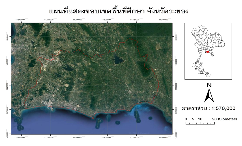
Sea level rise is a major global problem as a consequence of global warming. This research aims to study climate change on sea level rise in Rayong province during the years 2021-2099 using spatial data, GMTED21000 numerical altitude data and the HadGEN2-ES global climate model were used to calculate precipitation and average annual temperatures and using spatial raster calculation method for determining the volume of sea level rise in 8 periods. The results were showed that the highest mean annual precipitation was in 2092 (164.21 mm.), and the lowest was in 2090 (108.77 mm.) 2080 with 27.82 C° and the mean minimum temperature appears in 2026 at an average temperature of 26.13 C°. In addition, during the year 2092-2099 the highest increase was 0.2528 m. representing an increase in water volume of 4,266,000 m3 (35.05%), followed by the years 2080-2091 with an increase of 0.2208 m., representing an increase in water volume of 3,726,000 m3 (30.61%). Moreover, areas affected by sea level rise was found that the sub-district that was most affected was Thang Kwian and Pak Nam Pran followed by Khlong Pun, Pang Rad, Noen Kho, Map Ta Phut, Noen Phra, Pak Nam, Tha Pra Du, Choeng Noen, Phe, Phe, Klaeng, Sak Phong, Kram, and Kong Din sub-district respectively. Relevant agencies should prepare to deal with sea level rise in order to prevent future hazards.
References
กรมส่งเสริมคุณภาพสิ่งแวดล้อม. (2564). จมไม่จม? มาเปิดดูแผนที่ระดับน้ำทะเลในกรุงเทพ อีก 10 ปี จะเป็นอย่างไร. สืบค้นจาก https://greendigitallibrary.deqp.go.th/news/detail/788
จิรสรณ์ สันติสิริสมบูรณ์, สมเกียรติ อภิพัฒนวิศว์, ชิษณุชา บุดดาบุญ, จารุทัศน์ สันติสิริสมบูรณ์, วรัญญู วงษ์เสรี, ยอด สุขะมงคล, เบญจมาส รสโสภา, ขวัญฤทัย ศรีแสงฉาย, ประหยัด เลวัน, มนชัย ชอบธรรม และ ทรงศักดิ์ ช่วยบำรุง. (2559). รายงานฉบับสมบูรณ์เสนอต่อสำนักงานกองทุนสนับสนุนการวิจัย เรื่องการลดขนาดแบบจำลองภูมิอากาศโลกเพื่อการศึกษาผลกระทบการเปลี่ยนแปลงภูมิอากาศต่อการผลิตข้าวของประเทศไทย.
Bellouin, N., Collins, W. J., Culverwell, I. D., Halloran, P. R., Hardiman, S. C., Hinton, T. J., & Wiltshire, A. (2011). The HadGEM2 family of met office unified model climate configurations. Geoscientific Model Development, 4(3), 723-757.
Caesar, J., Palin, E., Liddicoat, S., Lowe, J., Burke, E., Pardaens, A., ... & Kahana, R. (2013). Response of the HadGEM2 earth system model to future greenhouse gas emissions pathways to the year 2300. Journal of Climate, 26(10), 3275-3284.
Change, I. P. O. C. (2007). Climate change 2007: The physical science basis.
Collins, W. J., Bellouin, N., Doutriaux-Boucher, M., Gedney, N., Halloran, P., Hinton, T., & Woodward, S. (2011). Development and evaluation of an Earth-System model–HadGEM2. Geoscientific Model Development, 4(4), 1051-1075.
Jones, C., Hughes, J. K., Bellouin, N., Hardiman, S. C., Jones, G. S., Knight, J., & Zerroukat, M. (2011). The HadGEM2-ES implementation of CMIP5 centennial simulations. Geoscientific Model Development, 4(3), 543-570.
Jones, R. G., Noguer, M., Hassell, D. C., Hudson, D., Wilson, S. S., Jenkins, G. J., & Mitchell, J. F. B. (2004). Generating high resolution climate change scenarios using PRECIS. Exeter, UK: Met Office Hadley Centre.
McCarthy, J. J., Canziani, O. F., Leary, N. A., Dokken, D. J., & White, K. S. (Eds.). (2001). Climate change 2001: impacts, adaptation, and vulnerability: contribution of Working Group II to the third assessment report of the Intergovernmental Panel on Climate Change (Vol. 2). Cambridge University Press.
Moss, R. H., Edmonds, J. A., Hibbard, K. A., Manning, M. R., Rose, S. K., Van Vuuren, D. P., & Wilbanks, T. J. (2010). The next generation of scenarios for climate change research and assessment. Nature, 463(7282), 747-756.
USGS. (2018). USGS EROS Archive - Digital Elevation - Global Multi-resolution Terrain Elevation Data 2010 (GMTED2010). Retrieved from https://www.usgs.gov/coastal-changes-and-impacts/gmted2010