Spatial Data Management and 3D Visualization using Unmanned Aerial Vehicle: A Case Study in Kokjun village, Phuka subdistrict, Pua district, Nan province, Thailand
Keywords:
Geoinformatics, Unmanned Aerial Vehicle, 3D visualizationAbstract
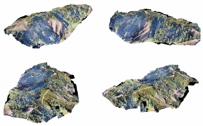
The main objective of this paper is to explore and create a spatial database. The study area was Ban Kok Jun, Pue district, Nan province, Thailand. Which is an area that has experienced a flood disaster by using unmanned aerial vehicle (UAV), eBee, for surveying with 500 meter high of mean sea level. The product is aerial photo images mapping with 4 centimeter resolution, digital surface model (DSM) data and using QGIS software for the processed 3D modelling respectively. The aerial mapping was investigation for extraction spatial database consist of 9GIS layers; Facility, Landmark, TS_PT, Contour, L_Trans, Ground_cover, Ground_plant, Landuse, and TS_Poly respectively. This research was transferred the method of creating a community-level spatial and environmental database and 3D mapping to offers.