Forest Encroachment Risk Area Determination and Sensitivity Analysis: A Case Study of National Park in Phayao Province
Keywords:
Sensitivity analyses, Multicriteria Decision Making, Forest Encroachment Risk AreaAbstract
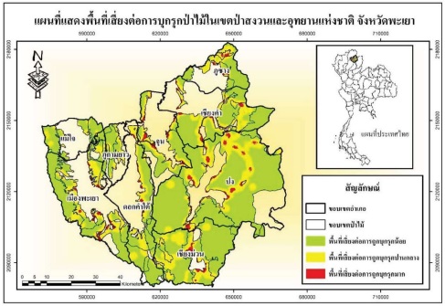
The objectives of this study were 1) to generate the physical criterion map and determinate forest encroachment risk area using geographic information system and, 2) to analyze sensitivity to ranking risk areas of forest encroachment. After criterion map generation, weights of criteria were determined by two groups (forest officer and local people living around the forest boundary). 5 criterion maps were overlaid for risk score calculation e.g., road, village, water body, elevation and slope. The result showed that there were three risk levels i.e., high, moderate and low. Their areas further summed up to 15.82, 32.78 and 51.40 percent of total, respectively. The result showed also that the elevation data value has more effect on the risk ranking.