The Relationship between Land use Patterns and the Spatial Outbreak of Dengue Hemorrhagic Fever in Phayao Province
Keywords:
Information Value Based Analysis, Dengue Hemorrhagic Fever, Geographic Information SystemsAbstract
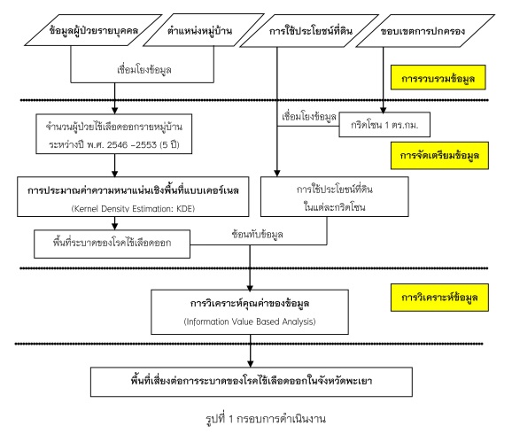
The objective of this study was to study the relationship between land use patterns and the spatial outbreak of Dengue Hemorrhagic Fever (DHF) in Phayao Province, northern Thailand. This study utilized data collecting from DHF patients at village level for the period 2006 – 2010 and Phayao land use map in 2009. A Geographic Information System (GIS) was used to prepare the spatial data for analyzing the outbreak areas of DHF. In data analysis, the information value method was used to calculate the information values between factors. Preliminary results demonstrated that the spatial statistical relationship of various land use classed with DHF-affected areas. The highest information value was obtained for the urban and built-up area. This indicated that built-up area had the maximum influence on the incidence of dengue. The risk areas of DHF occurred in the north and east of Kwan Phayao.