Weekly Spatiotemporal Dynamics of Forest Fire Hotspots in Tak Province, Thailand: A GIS-Based Directional Analysis
Article Sidebar
Main Article Content
Abstract
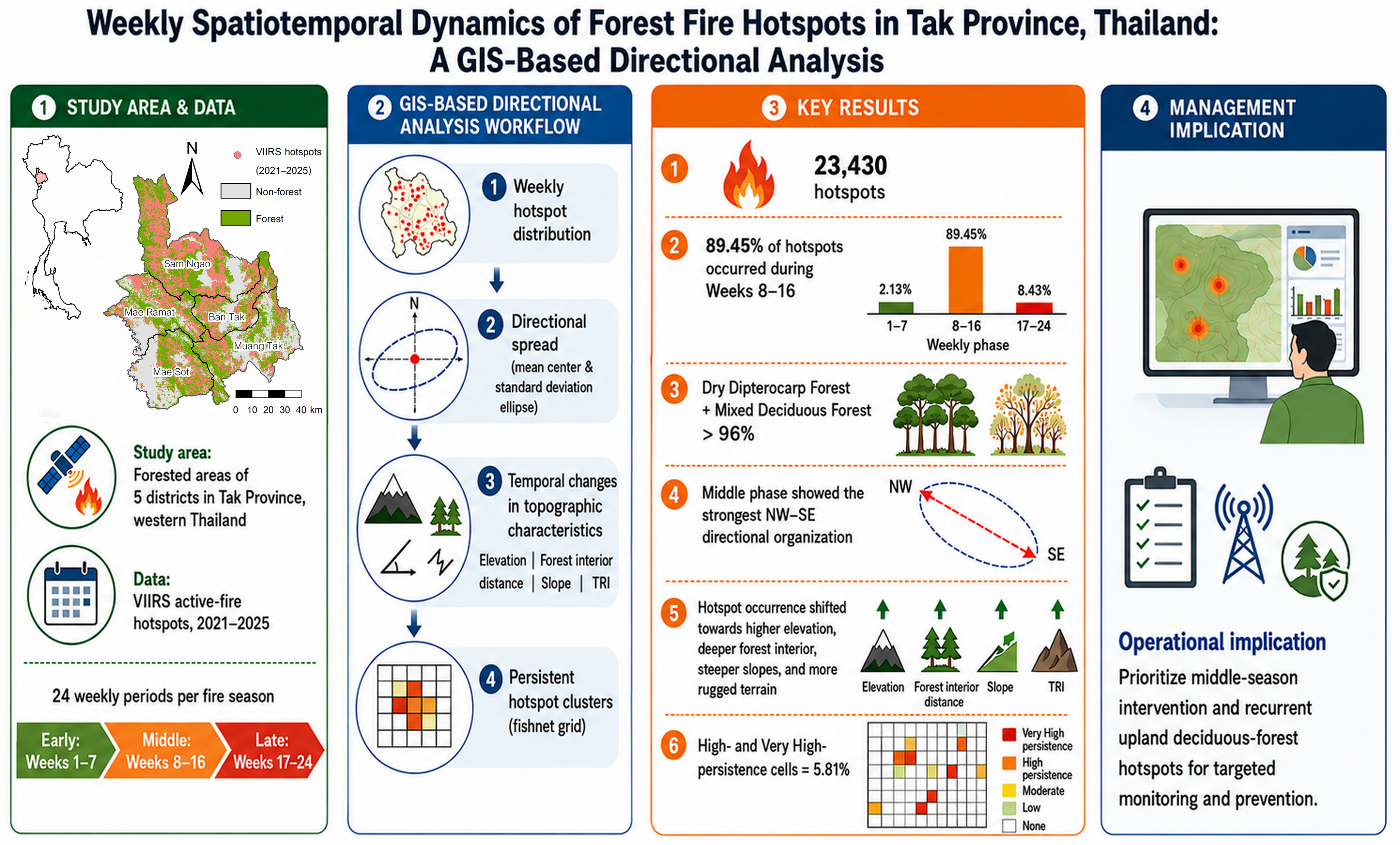
Forest fires are recurrent dry-season hazards in northern and western Thailand, yet their short-term spatial dynamics remain insufficiently understood. In this study, weekly spatiotemporal dynamics of forest fire hotspots in Tak Province, Thailand, were examined using Visible Infrared Imaging Radiometer Suite (VIIRS) active-fire data and GIS-based directional analysis. Hotspots from five fire seasons (2021–2025) were grouped into 24 weekly intervals beginning on 1 December. The analysis integrated weekly hotspot counts, forest-type compositions, mean-center trajectories, standard deviational ellipses, temporal changes in topographic characteristics, and fishnet-based hotspot persistence mapping. The results revealed that fire activity was highly concentrated during the middle of the fire season, with 20,957 hotspots or 89.45% of all detections occurring during weeks 8–16. Dry dipterocarp forest and mixed deciduous forest together accounted for more than 96% of all the hotspots. Directional analysis indicated that hotspot activity was not distributed randomly but became most spatially organized during the middle phase, when centroid movement was more consistent and hotspot distributions showed a stable northwest–southeast directional alignment. Weekly hotspot occurrence also shifted toward higher elevations, deeper forest interiors, steeper slopes, and more rugged terrain as the fire season progressed. Persistence analysis further revealed that high- and very high-persistence cells represented only 5.81% of the grid system but formed recurrent fire-prone cores concentrated in deciduous mountain forests. These findings demonstrate that forest fire activity in Tak Province is characterized by seasonal concentration, directional organization, temporal changes in topographic characteristics, and spatial persistence. The GIS-based directional framework provides an operational basis for identifying priority periods and locations for targeted fire monitoring and prevention.
Article Details

This work is licensed under a Creative Commons Attribution-NonCommercial 4.0 International License.
Published articles are under the copyright of the Applied Environmental Research effective when the article is accepted for publication thus granting Applied Environmental Research all rights for the work so that both parties may be protected from the consequences of unauthorized use. Partially or totally publication of an article elsewhere is possible only after the consent from the editors.
