Spatial Modeling of Natural Disaster Risk by Integrating Hazard, Vulnerability, and Exposure Factors using Geospatial Techniques: Evidence from Mueang Tak District, Thailand
Article Sidebar
Main Article Content
Abstract
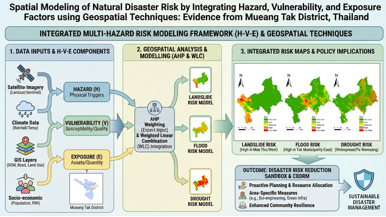
This study presents a comprehensive multihazard risk assessment for Mueang Tak District, Thailand, that integrates hazard, vulnerability, and exposure (H-V-E) dimensions. By utilizing geographic information systems (GIS) and remote sensing, the analytic hierarchy process (AHP) was employed to prioritize critical risk factors. GIS analysis integrated multisource spatial data, including Landsat 9 and Sentinel-2 imagery, CHIRPS precipitation, and SRTM-derived topography, while AHP weights were established on the basis of expert judgment and socioeconomic indices such as the relative wealth index (RWI) and population statistics. The results delineate distinct spatial risk clusters: high landslide potential is concentrated in the steep terrain of Mae Tho subdistrict, critical flood exposure affects the urbanized lowlands of Tak Municipality, and severe drought vulnerability characterizes the rain-fed agricultural belts of Pa Mamuang and Wang Prachop. These spatially explicit findings demonstrate the robustness of the integrated geospatial model, providing essential data to guide local policy-makers in establishing “Disaster Risk Reduction Sandbox” areas and enhancing community resilience against compounding natural hazards.
Article Details

This work is licensed under a Creative Commons Attribution-NonCommercial 4.0 International License.
Published articles are under the copyright of the Applied Environmental Research effective when the article is accepted for publication thus granting Applied Environmental Research all rights for the work so that both parties may be protected from the consequences of unauthorized use. Partially or totally publication of an article elsewhere is possible only after the consent from the editors.
