Applying Radom Forest and Support Vector Machine for Land-use Classification in Phu Giao District Vietnam
Article Sidebar
Main Article Content
Abstract
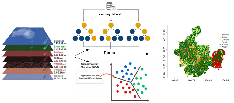
Machine learning algorithms are currently widely used to classify satellite images to create surface maps of the earth. Support vector machines (SVMs) and random forests (RFs) are more effective ML algorithms and more accurate classifications than other methods. The aim of this study is to analyze the performance of these two algorithms in land-use and land cover classification. For this purpose, the Landsat 8 OLI satellite image freely provided by the United States Geological Survey (USGS) was used to classify land use in the Phu Giao District, Binh Duong Province, Vietnam, where forestland is being strongly converted into rubber plantations and cultivated land. The results revealed that the accuracies of the SVM model were 0.87 (overall accuracy) and 0.89 (Cohen’s kappa), which are 2% lower than those of the optimal RF model. The land-use classification maps can be used as essential information in ecological and environmental management, such as natural habitats, urbanization and deforestation status, and species impact. Therefore, accurate and objective data/tools are extremely important.
Article Details

This work is licensed under a Creative Commons Attribution-NonCommercial 4.0 International License.
Published articles are under the copyright of the Applied Environmental Research effective when the article is accepted for publication thus granting Applied Environmental Research all rights for the work so that both parties may be protected from the consequences of unauthorized use. Partially or totally publication of an article elsewhere is possible only after the consent from the editors.
