Spatiotemporal Patterns of Land Surface Temperature, Urban Heat Island, and Potential Heat Stress Risk Areas Assessment for Tropical Inland City and Coastal City in Thailand
Main Article Content
Abstract
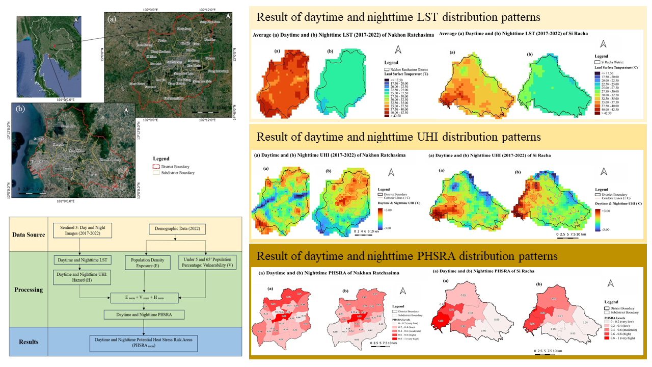
Global warming and rapid urban growth, compounded by the urban heat island (UHI) effect, are posing substantial challenges for urban populations and ecological well-being due to increased heat stress risks. This study aimed to analyze the spatiotemporal patterns of land surface temperature (LST), UHI, and potential heat stress risk areas (PHSRA) in two distinct cities, an inland city, Nakhon Ratchasima, and a coastal city, Si Racha, during the summer. Geoinformatics techniques and Crichton’s Risk Triangle method were employed, using updated demographic data and Sentinel-3 data from 2017 to 2022. The findings indicate that the inland city daytime average LST values were higher than in the coastal city, while the opposite was true at nighttime. Additionally, high daytime UHI patterns in the inland city were observed on the outskirts, and nighttime UHI concentrated in the urban center. The coastal city exhibited a strong daytime and nighttime UHI compared to the inland city, with daytime UHI peaking in the inner area and nighttime UHI near the coastline. The PHSRA was categorized into five risk levels (very high: > 0.8, high: 0.8–0.6, moderate: 0.6–0.4, low: 0.4–0.2 and very low: ≤ 0.2). During the daytime the highest risk areas, the high and very high levels of PHSRA in the inland city (23.84%) were greater than those in the coastal city (16.46%). Conversely, at nighttime, the coastal city (16.46%) exhibited higher levels than the inland city (5.26%). In nighttime conditions, all levels of PHSRA occurred more significantly than during the daytime in these cities. Understanding the spatiotemporal variations in PHSRA is vital for pinpointing places at risk of heat stress accidents in summer. This data is a goldmine for city planners and healthcare authorities, helping them plan interventions and effective measures for the future.
Article Details

This work is licensed under a Creative Commons Attribution-NonCommercial 4.0 International License.
Published articles are under the copyright of the Applied Environmental Research effective when the article is accepted for publication thus granting Applied Environmental Research all rights for the work so that both parties may be protected from the consequences of unauthorized use. Partially or totally publication of an article elsewhere is possible only after the consent from the editors.

