Rice canopy height model assessment using unmanned aerial vehicle (UAV) images
Keywords:
canopy height model, UAV, paddy fieldAbstract
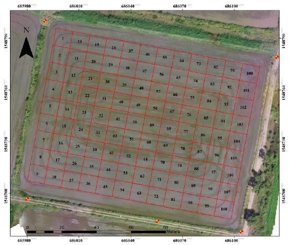
Precision agriculture implementation is currently increasing in Thailand, especially in rice cultivation. Accurate information is an essential factor in efficient rice field management. Apart from the vegetation indices, plant height (PH) is critical for crop monitoring and yield prediction. However, field height measurements could cause crop damage and take much time. This study utilizes the capability of an unmanned aerial vehicle (UAV) to construct the canopy height model (CHM) remotely. The samples are collected in the tillering and booting stage for 108 plots, representing the physical extension (e.g., rice elongation and reproduction, respectively). The CHM of each plot is determined at 91 to 99 percentiles. The result revealed that the best linear relationship between the CHM and field PH in both stages was found at the 99th percentile (r2 = 0.87 and 0.86, respectively). The RMS error of plant height was reported 1.83 and 1.71 cm from the prediction (p < 0.01). This experiment authenticates that the UAV could accurately obtain the PH without invading the field. Therefore, it is a good practice for achieving rice physical information and preventing crop destruction.
Downloads
Published
Issue
Section
Categories
License
Copyright (c) 2022 The Journal of Applied Science

This work is licensed under a Creative Commons Attribution-NonCommercial-NoDerivatives 4.0 International License.

