
Impact of Urbanization on Urban Heat Island and Urban Thermal Field Variance Index of Coastal City Surabaya, Indonesia between 2005 and 2020
Article Sidebar
Main Article Content
Abstract
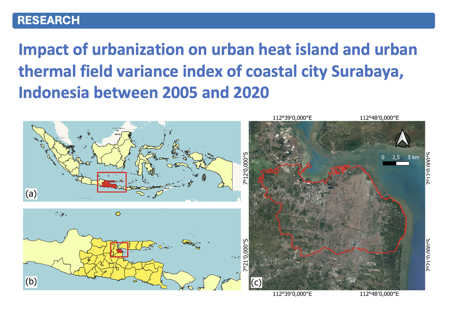
The city of Surabaya serves as the capital of East Java Province, Indonesia, experiencing the most intensive anthropogenic activities in this province. It has emerged as a primary destination for urbanization from various regions, leading to notable shifts in land use, vegetation, and Land Surface Temperature (LST). This study aims to analyzing the impact of urbanization on urban heat island and urban thermal field variance of coastal city Surabaya, Indonesia between 2005 and 2020. The findings reveal that Land Use Land Cover (LULC) changes significantly impact LST in Surabaya. Pearson Correlation results showed a positive correlation between Normalized Difference Vegetation Index, Urban Thermal Field Variance Index, and Urban Heat Island in 2005, 2011, 2015 and 2020 (p < 0.01). Alterations in land use contribute to elevated surface temperatures owing to diminished vegetation and increased built-up areas, thereby exacerbating ecological degradation and posing health risks to the urban environment. Consequently, implementing mitigation and adaptation measures becomes imperative to address the escalating urban heat phenomenon. Strategies such as augmenting green infrastructure and optimizing blue infrastructure are crucial for maintaining thermal equilibrium across the urban landscape.
Article Details

This work is licensed under a Creative Commons Attribution-NonCommercial-NoDerivatives 4.0 International License.
All authors need to complete copyright transfer to Journal of Applied Informatics and Technology prior to publication. For more details click this link: https://ph01.tci-thaijo.org/index.php/jait/copyrightlicense


References
Achmad, A., Sari, L. H., and Ramli, I. (2019). A study of urban heat island of Banda Aceh City, Indonesia based on land use/cover changes and land surface temperature. Aceh International Journal of Science and Technology, 8(1):41–51. DOI: 10.13170/aijst.8.1.13060.
Adawiyah, H. (2021). Analisis sistem informasi geografis perubahan penggunaan lahan di kecamatan labuhan haji. Geodika: Jurnal Kajian Ilmu dan Pendidikan Geografi, 5(1):174–184. DOI: 10.29408/geodika.v5i1.3674.
Alademomi, A. S., Okolie, C. J., Daramola, O. E., Akinnusi, S. A., Adediran, E., Olanrewaju, H. O., Alabi, A. O., Salami, T. J., and Odumosu, J. (2022). The interrelationship between LST, NDVI, NDBI, and land cover change in a section of lagos metropolis, nigeria. Applied Geomatics, 14(2):299–314. DOI: 10.1007/s12518-022-00434-2.
AlDousari, A. E., Kafy, A. A., Saha, M., Fattah, M. A., Almulhim, A. I., Faisal, A.-A., Al Rakib, A., Jahir, D. M. A., Rahaman, Z. A., Bakshi, A., Shahrier, M., and Rahman, M. M. (2022). Modelling the impacts of land use/land cover changing pattern on urban thermal characteristics in Kuwait. Sustainable Cities and Society, 86:104107. DOI: 10.1016/j.scs.2022.104107.
Alizadeh, H. and Sharifi, A. (2020). Assessing resilience of urban critical infrastructure networks: A case study of Ahvaz, Iran. Sustainability, 12(9):3691. DOI: 10.3390/su12093691.
Almaaitah, T., Appleby, M., Rosenblat, H., Drake, J., and Joksimovic, D. (2021). The potential of blue-green infrastructure as a climate change adaptation strategy: A systematic literature review. Blue-Green Systems, 3(1):223–248. DOI: 10.2166/bgs.2021.016.
Bala, R., Prasad, R., and Yadav, V. P. (2021). Quantification of urban heat intensity with land use/land cover changes using landsat satellite data over urban landscapes. Theoretical and Applied Climatology, 145(1–2):1–12. DOI: 10.1007/s00704-021-03610-3.
Bokaie, M., Zarkesh, M. K., Arasteh, P. D., and Hosseini, A. (2016). Assessment of urban heat island based on the relationship between land surface temperature and land use/ land cover in Tehran. Sustainable Cities and Society, 23:94–104. DOI: 10.1016/j.scs.2016.03.009.
Chairuman, M., Wihadanto, A., and Rusdiyanto, E. (2023). Perubahan penggunaan lahan Perkotaan dan fenomena urban heat island di Kota Tangerang Selatan. ULIN: Jurnal Hutan Tropis, 7(2):142. DOI: 10.32522/u-jht.v7i2.10375.
Choudhury, D., Das, K., and Das, A. (2019). Assessment of land use land cover changes and its impact on variations of land surface temperature in Asansol-Durgapur development region. The Egyptian Journal of Remote Sensing and Space Science, 22(2):203–218. DOI: 10.1016/j.ejrs.2018.05.004.
Chung, J., Lee, Y., Jang, W., Lee, S., and Kim, S. (2020). Correlation analysis between air temperature and MODIS land surface temperature and prediction of air temperature using TensorFlow long short-term memory for the period of occurrence of cold and heat waves. Remote Sensing, 12(19):3231. DOI: 10.3390/rs12193231.
Congedo, L. (2021). Semi-automatic classification plugin: A python tool for the download and processing of remote sensing images in QGIS. Journal of Open Source Software, 6(64):3172. DOI: 10.21105/joss.03172.
Cuce, E., Sher, F., Sadiq, H., Cuce, P. M., Guclu, T., and Besir, A. B. (2019). Sustainable ventilation strategies in buildings: CFD research. Sustainable Energy Technologies and Assessments, 36:100540. DOI: 10.1016/j.seta.2019.100540.
Das, S. and Angadi, D. P. (2020). Land use-land cover (LULC) transformation and its relation with land surface temperature changes: A case study of barrackpore subdivision, West Bengal, India. Remote Sensing Applications: Society and Environment, 19:100322. DOI: 10.1016/j.rsase.2020.100322.
Dash, P., Sanders, S. L., Parajuli, P., and Ouyang, Y. (2023). Improving the accuracy of land use and land cover classification of landsat data in an agricultural watershed. Remote Sensing, 15(16):4020. DOI: 10.3390/rs15164020.
Demuzere, M., Orru, K., Heidrich, O., Olazabal, E., Geneletti, D., Orru, H., Bhave, A., Mittal, N., Feliu, E., and Faehnle, M. (2014). Mitigating and adapting to climate change: Multi-functional and multiscale assessment of green urban infrastructure. Journal of Environmental Management, 146:107–115. DOI: 10.1016/j.jenvman.2014.07.025.
Dutta, K., Basu, D., and Agrawal, S. (2021). Evaluation of seasonal variability in magnitude of urban heat islands using local climate zone classification and surface albedo. International Journal of Environmental Science and Technology, 19(9):8677–8698. DOI: 10.1007/s13762-021-03602-w.
Ermawati, M., Syahputra, A., and Mutmainah, T. (2022). Analisis faktor-faktor yang mempengaruhi urban heat island di kota bandarlampung. Reka Ruang, 5(2):54–66.
Estoque, R. C. and Murayama, Y. (2017). Monitoring surface urban heat island formation in a tropical mountain city using Landsat data (1987–2015). ISPRS Journal of Photogrammetry and Remote Sensing, 133:18–29. DOI: 10.1016/j.isprsjprs.2017.09.008.
Faza Illiyin, D., Martokusumo, W., and Donny Koerniawan, M. (2019). Analysis of correlation betweeen urban structure parameters and climatic variables in heritage area of Rajawali-Surabaya as urban heat island mitigation. KnE Social Sciences. DOI: 10.18502/kss.v3i21.4969.
Florim, I., Albert, B., and Shpejtim, B. (2021). Measuring UHI using Landsat-8 OLI and TIRS data with NDVI and NDBI in municipality of Prishtina. Disaster Advances, 14(11):25–36.
Gandhi, G. M., Parthiban, S., Thummalu, N., and Christy, A. (2015). Ndvi: Vegetation change detection using remote sensing and Gis – A case study of Vellore District. Procedia Computer Science, 57:1199–1210. DOI: 10.1016/j.procs.2015.07.415.
Gohain, K. J., Goswami, A., Mohammad, P., and Kumar, S. (2023). Modelling relationship between land use land cover changes, land surface temperature and urban heat island in Indore city of central India. Theoretical and Applied Climatology, 151(3–4):1981–2000. DOI: 10.1007/s00704-023-04371-x.
Gunathilaka, M. D. K. L. and Harshana, W. T. S. (2021). Evaluation of urban heat island (UHI) spatial change in freshwater lakes with hot spot analysis (GI statistics). International Journal of Environment, Engineering and Education, 3(2):48–58. DOI: 10.55151/ijeedu.v3i2.54.
Hadibasyir, H. Z., Fikriyah, V. N., Sunariya, M. I. T., and Danardono, D. (2020). Pemetaan kondisi ekologi perkotaan skala mikro menggunakan citra Landsat 8 di kota semarang. LaGeografia, 18(3):209. DOI: 10.35580/lageografia.v18i3.13476.
Hadibasyir, H. Z. and Firdaus, N. S. (2023). Spatial analysis of urban ecological condition in Denpasar city, Indonesia using Landsat 9 imagery. Jurnal Purifikasi, 21(1):38–44. DOI: 10.12962/j25983806.v21.i1.429.
Handayani, M. F., Parsudi, S., and Sudarto, T. (2017). Dampak pembebasan lahan pertanian untuk jalan tol Surabaya - mojokerto (sumo) terhadap kualitas hidup petani bekas pemilik lahan di sumberwaru, wringinanom – gresik. Berkala Ilmiah Agridevina, 5(2). DOI: 10.33005/adv.v5i2.820.
Islami, F. A., Tarigan, S. D., Wahjunie, E. D., and Dasanto, B. D. (2022). Accuracy assessment of land use change analysis using Google Earth in Sadar Watershed Mojokerto regency. IOP Conference Series: Earth and Environmental Science, 950(1):012091. DOI: 10.1088/1755-1315/950/1/012091.
Isnaeni, A. Y. and Prasetyo, S. Y. J. (2022). Klasifikasi wilayah potensi risiko kerusakan lahan akibat bencana tsunami menggunakan machine learning. Jurnal Teknik Informatika dan Sistem Informasi, 8(1). DOI: 10.28932/jutisi.v8i1.4056.
Izah, A., Shafarani, F. K., Afrianto, F., and Permana, M. (2023). Hubungan antara kepadatan vegetasi dan land surface temperature di kabupaten pasuruan. Jurnal Plano Buana, 4(1):12–21.
Ji, Y., Zhan, W., Du, H., Wang, S., Li, L., Xiao, J., Liu, Z., Huang, F., and Jin, J. (2023). Urban-rural gradient in vegetation phenology changes of over 1500 cities across China jointly regulated by urbanization and climate change. ISPRS Journal of Photogrammetry and Remote Sensing, 205:367–384. DOI: 10.1016/j.isprsjprs.2023.10.015.
Kafle, S. C. (2019). Correlation and regression analysis using spss. Management, Technology & Social Sciences, page 126. Retrieved from Oxford College Journal.
Kafy, A. A., Abdullah-Al-Faisal, Rahman, M. S., Islam, M., Al Rakib, A., Islam, M. A., Khan, M. H. H., Sikdar, M. S., Sarker, M. H. S., Mawa, J., and Sattar, G. S. (2021). Prediction of seasonal urban thermal field variance index using machine learning algorithms in Cumilla, Bangladesh. Sustainable Cities and Society, 64:102542. DOI: 10.1016/j.scs.2020.102542.
Karaku¸s, C. B. (2019). The impact of land use/land cover (LULC) changes on land surface temperature in Sivas City Center and its surroundings and assessment of urban heat island. Asia-Pacific Journal of Atmospheric Sciences, 55(4):669–684. DOI: 10.1007/s13143-019-00109-w.
Katherina, L. K. and Indraprahasta, G. S. (2019). Urbanization pattern in Indonesia’s secondary cities: Greater Surabaya and its path toward a megacity. IOP Conference Series: Earth and Environmental Science, 338(1):012018. DOI: 10.1088/1755-1315/338/1/012018.
Khafid, M. A., Wicaksono, A. P., and Dewantoro, B. E. B. (2020). Method of land cover change and number of vehicles increasing on land surface temperature: Case research of Surabaya City, East Java Province, Indonesia. International Journal of Innovative Technology and Exploring Engineering, 9(3S):177–181. DOI: 10.35940/ijitee.c1039.0193s20.
Khamchiangta, D. and Dhakal, S. (2020). Time series analysis of land use and land cover changes related to urban heat island intensity: Case of Bangkok metropolitan area in Thailand. Journal of Urban Management, 9(4):383–395. DOI: 10.1016/j.jum.2020.09.001.
Khanh, D. N., Varquez, A. C., and Kanda, M. (2023). Impact of urbanization on exposure to extreme warming in megacities. Heliyon, 9(4):e15511. DOI: 10.1016/j.heliyon.2023.e15511.
Kikon, N., Kumar, D., and Ahmed, S. A. (2023). Quantitative assessment of land surface temperature and vegetation indices on a kilometer grid scale. Environmental Science and Pollution Research, 30(49):107236–107258. DOI: 10.1007/s11356-023-27418-y.
Kumari, M., Sarma, K., and Sharma, R. (2019). Using Moran’s I and GIS to study the spatial pattern of land surface temperature in relation to land use/cover around a thermal power plant in Singrauli district, Madhya Pradesh, India. Remote Sensing Applications: Society and Environment, 15:100239. DOI: 10.1016/j.rsase.2019.100239.
Kurniati, A. C. and Nitivattananon, V. (2016). Factors influencing urban heat island in Surabaya, Indonesia. Sustainable Cities and Society, 27:99–105. DOI: 10.1016/j.scs.2016.07.006.
Kushardono, D. (2017). Klasifikasi Digital pada Penginderaan Jauh. IPB Press, Bogor, Indonesia.
Kusuma, R. D., Purnomo, E. P., and Kasiwi, A. N. (2020). Analisis upaya kota Surabaya untuk mewujudkan kota hijau (green city). Dinamika : Jurnal Ilmiah Ilmu Administrasi Negara, 7(1):13–27. DOI: 10.25157/dinamika.v7i1.3173.
Leal Filho, W., Echevarria Icaza, L., Neht, A., Klavins, M., and Morgan, E. A. (2018). Coping with the impacts of urban heat islands. A literature based study on understanding urban heat vulnerability and the need for resilience in cities in a global climate change context. Journal of Cleaner Production, 171:1140–1149. DOI: 10.1016/j.jclepro.2017.10.086.
Malik, M. S., Shukla, J. P., and Mishra, S. (2019). Relationship of LST, NDBI and NDVI using Landsat-8 data in Kandaihimmat watershed, Hoshangabad, India. Indian Journal of Geo Marine Science, 48(1):25–31.
Marsitha Barung, F., Jan Pattipeilohy, W., and Muharsyah, R. (2021). Assessment of climate change based on annual trend and change of temperature in manokwari, west papua. Jurnal Analisis Kebijakan Kehutanan, 18(1):45–57. DOI: 10.20886/jakk.2021.18.1.45-57.
Melati, F. S., Sukmono, A., and Bashit, N. (2020). Analisis pengaruh perubahan densifikasi bangunan terhadap fenomena urban heat island menggunakan algoritma urban index dengan citra landsat multitemporal (studi kasus: Kota pekalongan). Jurnal Geodesi Undip, 9:166–175.
Mia, B., Bhattacharya, R., and Woobaidullah, A. (2017). Urban heat island with land use-land cover of Dhaka City using satellite imageries. International Journal of Research in Geography, 3(4). DOI: 10.20431/2454-8685.0304002.
Moazzam, M. F. U., Doh, Y. H., and Lee, B. G. (2022). Impact of urbanization on land surface temperature and surface urban heat island using optical remote sensing data: A case study of jeju island, republic of korea. Building and Environment, 222:109368. DOI: 10.1016/j.buildenv.2022.109368.
Mokarram, M., Taripanah, F., and Pham, T. M. (2023). Investigating the effect of surface urban heat island on the trend of temperature changes. Advances in Space Research, 72(8):3150–3169. DOI: 10.1016/j.asr.2023.06.048.
Mulyaqin, T. (2020). Pengaruh el nino dan la nina terhadap fluktuasi produksi padi di provinsi banten. Jurnal Agromet, 34(1):34–41.
Nailufar, B. (2018). Analisis perubahan indeks kerapatan vegetasi dengan metode analisis normalized difference vegetation index (NDVI) di kota batu berbasis sistem informasi geografis (GIS) dan pengindraan jauh. Mintakat: Jurnal Arsitektur, 19(2). DOI: 10.26905/mintakat.v19i2.2356.
Noviyanti, E. and Santoso, E. B. (2016). Factors affect of urban heat island from city form and city function in downtown Surabaya City (UP. Tunjungan). International Journal of Engineering Research & Technology, 5(1):345–352. DOI: 10.17577/IJERTV5IS010262.
Olofsson, P., Foody, G. M., Herold, M., Stehman, S. V., Woodcock, C. E., and Wulder, M. A. (2014). Good practices for estimating area and assessing accuracy of land change. Remote Sensing of Environment, 148:42–57. DOI: 10.1016/j.rse.2014.02.015.
Omali, T. U. (2020). Ecological evaluation of urban heat island impacts in Abuja municipal area of FCT Abuja, Nigeria. World Academics Journal of Engineering Sciences, 7:66–72.
O’Malley, C., Piroozfar, P., Farr, E. R., and Pomponi, F. (2015). Urban heat island (UHI) mitigating strategies: A case-based comparative analysis. Sustainable Cities and Society, 19:222–235. DOI: 10.1016/j.scs.2015.05.009.
Pan, Y., Zhang, H., Wang, C., and Zhou, Y. (2023). Impact of land use change on regional carbon sink capacity: Evidence from Sanmenxia, China. Ecological Indicators, 156:111189. DOI: 10.1016/j.ecolind.2023.111189.
Park, J., Shin, Y., Kim, S., Lee, S.-W., and An, K. (2022). Efficient plant types and coverage rates for optimal green roof to reduce urban heat island effect. Sustainability, 14(4):2146. DOI: 10.3390/su14042146.
Prasetyo, B. D. and Nurtyawan, R. (2023). Analisis urban heat island di kota semarang berdasarkan hubungan kerapatan vegetasi dan keterbangunan kota terhadap suhu permukaan. In Prosiding FTSP Series, pages 284–289.
Pratiwi, A. Y. and Jaelani, L. M. (2021). Analisis perubahan distribusi urban heat island (UHI) di kota Surabaya menggunakan citra satelit Landsat multitemporal. Jurnal Teknik ITS, 9(2):48–55.
Prayogo, L. M. (2021). Platform Google Earth engine untuk pemetaan suhu permukaan daratan dari data series modis. DoubleClick: Journal of Computer and Information Technology, 5(1):25. DOI: 10.25273/doubleclick.v5i1.8604.
Putra, A. K., Sukmono, A., and Sasmito, B. (2018). Analisis hubungan perubahan tutupan lahan terhadap suhu permukaan terkait fenomena urban heat island menggunakan citra landsat (studi kasus: Kota surakarta). Jurnal Geodesi Undip, 7(3):22–31. DOI: 10.14710/jgundip.2018.21212.
Putra, I. K. G. A. P., Risdiyanto, I., and Hidayat, R. (2023). Correlation analysis between urban heat island intensity and temperature criticality value in Denpasar City. Agromet, 37(2):66–76. DOI: 10.29244/j.agromet.37.2.66-76.
Rahardian, D. and Ruslana, d. Z. N. (2022). Hubungan antara kerapatan dan jenis vegetasi terhadap kejadian angin puting beliung di kabupaten kendal tahun 2017-2021. Buletin Meteorologi, Klimatologi dan Geofisika, 2(6):25–34.
Rushayati, S. B., Prasetyo, L. B., Puspaningsih, N., and Rachmawati, E. (2016). Adaptation strategy toward urban heat island at tropical urban area. Procedia Environmental Sciences, 33:221–229. DOI: 10.1016/j.proenv.2016.03.073.
Safitri, R., Vonnisa, M., and Marzuki, M. (2022). Analisis dampak perubahan tutupan lahan di kalimantan terhadap temperatur permukaan. Jurnal Fisika Unand, 11(2):173–179. DOI: 10.25077/jfu.11.2.173-179.2022.
Safitri, W. R. (2016). Pearson correlation analysis to determine the relationship between city population density with incident dengue fever of Surabaya in the year 2012-2014. Jurnal Ilmiah Keperawatan (Scientific Journal of Nursing), 2(2):21–29.
Saha, S., Saha, A., Das, M., Saha, A., Sarkar, R., and Das, A. (2021). Analyzing spatial relationship between land use/land cover (LULC) and land surface temperature (LST) of three urban agglomerations (UAs) of Eastern India. Remote Sensing Applications: Society and Environment, 22:100507. DOI: 10.1016/j.rsase.2021.100507.
Saputra, A. A., Hakim, F. L., Mandala, M., and Indarto, I. (2023). Pemanfaatan citra landsat untuk pemantauan perubahan tutupan lahan lima dekade pada kawasan perkotaan dan aglomerasi industri provinsi Jawa timur. Seminar Nasional Teknik Sipil, 1(1):343–254.
Sari, D. P. (2021). A review of how building mitigates the urban heat island in Indonesia and tropical cities. Earth, 2(3):653–666. DOI: 10.3390/earth2030038.
Sarif, M. O., Rimal, B., and Stork, N. E. (2020). Assessment of changes in land use/land cover and land surface temperatures and their impact on surface urban heat island phenomena in the Kathmandu Valley (1988–2018). ISPRS International Journal of Geo-Information, 9(12):726. DOI: 10.3390/ijgi9120726.
Sasmito, B. and Suprayogi, A. (2017). Model kekritisan indeks lingkungan dengan algoritma urban heat island Di Kota Semarang. Majalah Ilmiah Globe, 19(1):45. DOI: 10.24895/mig.2017.19-1.509.
Setyawati, K. C., Ghifari, M. K., and Aribahwanto, M. A. (2022). Pengaruh pengaruh urban sprawl terhadap tata kota Surabaya. Journal of Economics Development Issues, 5(2):78–85. DOI: 10.33005/jedi.v5i2.122.
Seun, A. I., Ayodele, A. P., Koji, D., and Akande, S. O. (2022). The potential impact of increased urbanization on land surface temperature over south-west Nigeria. Current Research in Environmental Sustainability, 4:100142. DOI: 10.1016/j.crsust.2022.100142.
Silva, J. S., Silva, R. M. d., and Santos, C. A. G. (2018). Spatiotemporal impact of land use/land cover changes on urban heat islands: A case study of Pa¸co do Lumiar, Brazil. Building and Environment, 136:279–292. DOI: 10.1016/j.buildenv.2018.03.041.
Singh, P., Kikon, N., and Verma, P. (2017). Impact of land use change and urbanization on urban heat island in Lucknow city, Central India. A remote sensing based estimate. Sustainable Cities and Society, 32:100–114. DOI: 10.1016/j.scs.2017.02.018.
Singh, P., Verma, P., Chaudhuri, A. S., Singh, V. K., and Rai, P. K. (2023). Evaluating the relationship between urban heat island and temporal change in land use, NDVI and NDBI: A case study of Bhopal city, India. International Journal of Environmental Science and Technology, 21(3):3061–3072. DOI: 10.1007/s13762-023-05141-y.
Sugiarto, B. O. N. I. E. and Kebumian, L. D. (2018). Prediksi perubahan tutupan lahan akibat dampak pembangunan jembatan suramadu di kabupaten bangkalan. Jurnal Teknik Geomatika Fakultas Teknik Sipil Institut Teknologi Sepuluh Nopember.
Syafitri, R. A. W. D., Pamungkas, A., and Santoso, E. B. (2021). Urban form factors that play important roles on UHI spatial-temporal pattern: A case study of east Surabaya, Indonesia. IOP Conference Series: Earth and Environmental Science, 764(1):012030. DOI: 10.1088/1755-1315/764/1/012030.
Syamsu, I. F., Nugraha, A. Z., Nugraheni, C. T., and Wahwakhi, S. A. L. M. A. N. A. (2018). Kajian perubahan tutupan lahan di ekosistem mangrove pantai timur surabaya. Media Konservasi, 23(2):122–131.
Taufik, A., Syed Ahmad, S. S., and Ahmad, A. (2016). Classification of Landsat 8 satellite data using NDVI tresholds. Journal of Telecommunication, Electronic and Computer Engineering (JTEC), 8(4):37–40.
Tempa, K. and Aryal, K. R. (2022). Semi-automatic classification for rapid delineation of the geohazard-prone areas using Sentinel-2 satellite imagery. SN Applied Sciences, 4(5). DOI: 10.1007/s42452-022-05028-6.
Tepanosyan, G., Muradyan, V., Hovsepyan, A., Pinigin, G., Medvedev, A., and Asmaryan, S. (2021). Studying spatial-temporal changes and relationship of land cover and surface urban heat island derived through remote sensing in Yerevan, Armenia. Building and Environment, 187:107390. DOI: 10.1016/j.buildenv.2020.107390.
Tran, D. X., Pla, F., Latorre-Carmona, P., Myint, S. W., Caetano, M., and Kieu, H. V. (2017). Characterizing the relationship between land use land cover change and land surface temperature. ISPRS Journal of Photogrammetry and Remote Sensing, 124:119–132. DOI: 10.1016/j.isprsjprs.2017.01.001.
Ullah, N., Siddique, M. A., Ding, M., Grigoryan, S., Zhang, T., and Hu, Y. (2022). Spatiotemporal impact of urbanization on urban heat island and urban thermal field variance index of Tianjin City, China. Buildings, 12(4):399. DOI: 10.3390/buildings12040399.
Wafdan, L. (2020). Identifikasi klasifikasi lahan di kecamatan pakem kabupaten sleman berdasarkan intepretasi citra Sentinel-2. Jurnal Ilmiah Penalaran dan Penelitian Mahasiswa, 4(1):105–128.
Wu, K., Wang, D., Lu, H., and Liu, G. (2023). Temporal and spatial heterogeneity of land use, urbanization, and ecosystem service value in China: A national-scale analysis. Journal of Cleaner Production, 418:137911. DOI: 10.1016/j.jclepro.2023.137911.
Yao, R., Wang, L., Huang, X., Gong, W., and Xia, X. (2019). Greening in rural areas increases the surface urban heat island intensity. Geophysical Research Letters, 46(4):2204–2212. DOI: 10.1029/2018gl081816.
Yin, Z., Liu, Z., Liu, X., Zheng, W., and Yin, L. (2023). Urban heat islands and their effects on thermal comfort in the US: New York and New Jersey. Ecological Indicators, 154:110765. DOI: 10.1016/j.ecolind.2023.110765.
Ziar, H., S¨onmez, F. F., Isabella, O., and Zeman, M. (2019). A comprehensive albedo model for solar energy applications: Geometric spectral albedo. Applied Energy, 255:113867. DOI: 10.1016/j.apenergy.2019.113867.
