
Positional Accuracy Evaluation of Google Earth using RTK GNSS Network Surveying Case Study: Mahasarakham Province
Article Sidebar
Main Article Content
Abstract
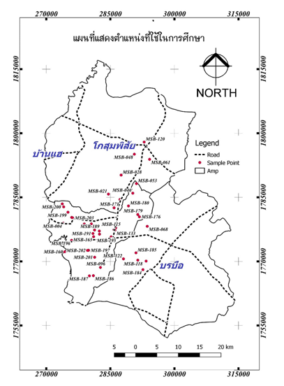
This study aims to provide an understanding of the horizontal positional accuracy and Google Earth height compare with Static GNSS surveying. The results showed the RMSE obtained in E, N, Z(EGM96), and Z (TGM2017) were 1.316, 1.331, 3.558, and 4.453 m. respectively with a horizontal error range of -2.834 m to 1.930 m and a vertical error range of -0.673 m to 8.874 m in all 48 measured points. The results show Google Earth cannot provide high accuracy coordinate and the height of google earth is not so sensitive to immediate changes in ground topography.
Article Details

This work is licensed under a Creative Commons Attribution-NonCommercial-NoDerivatives 4.0 International License.
All authors need to complete copyright transfer to Journal of Applied Informatics and Technology prior to publication. For more details click this link: https://ph01.tci-thaijo.org/index.php/jait/copyrightlicense


References
Charoenkalunyuta, T., Satirapod, C., Keitniyomrung, V., & Yomwan, P. (2019). Performance of network-based RTK GNSS for the cadastral survey in Thailand. International Journal of Geoinformatics, 15(3).
Damrongchai, P., & Duangdee, N. (2019). Evaluation of TGM2017 for height system using GNSS/Levelling data in Thailand. Transaction Journal of Engineering, Management, & Applied Sciences & Technologies, 10(10), 10A10N.
Farah, A., & Algarni, D. (2014). Positional accuracy assessment of Google Earth in Riyadh. Artificial Satellites, 49(2), 101-106.
Goudarzi, M. A., & Landry, R. J. (2017). Assessing horizontal positional accuracy of Google Earth imagery in the city of Montreal, Canada. Geodesy and Cartography, 43(2), 56-65.
Kattan, R., Abdulrahman, F., & Hassan, H. (2016). Evaluating the accuracy of Google Earth DEM using GPS Coordinates, case study: Duhok Governorate. Journal of University of Duhok (JDU), 19, 1-16.
Koivula, H., Kuokkanen, J., Marila, S., Lahtinen, S., & Mattila, T. (2018). Assessment of sparse GNSS network for network RTK. Journal of Geodetic Science, 8(1), 136-144.
Martin, A. A., & McGovern, E. (2012). An evaluation of the performance of network RTK GNSS services in Ireland. FIG Working Week.
Mulu, Y. A., & Derib, S. D. (2019). Positional Accuracy Evaluation of Google Earth in Addis Ababa, Ethiopia. Artificial Satellites, 54(2), 43-56.
Radicioni, F., Stoppini, A., Brigante, R., Brozzi, A., & Tosi, G. (2020). GNSS network RTK for automatic guidance in agriculture: Testing and performance evaluation. In International Conference on Computational Science and Its Applications (pp. 19-35). Springer, Cham.
Rusli, N., Pa’suya, M. F., & Talib, N. (2016). A comparative accuracy of Google Earth height with MyGeoid, EGM96 and MSL. In IOP Conference Series: earth and environmental science (pp. 1-6). IOP Conference Series.
