Integrated Geographic Information Systems for Agricultural Drip Systems Development
Abstract
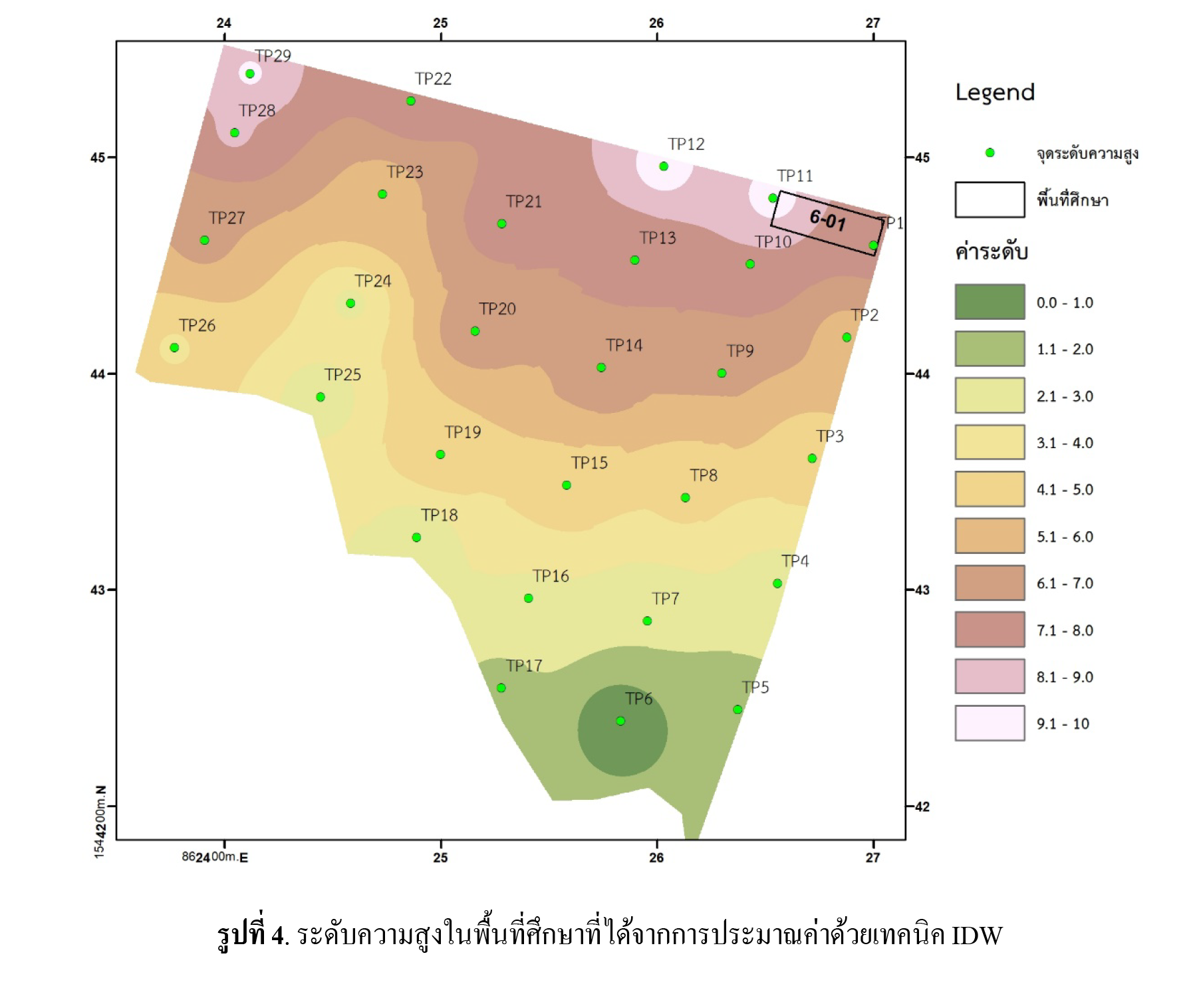
The problem of declining agricultural product prices and the increase of population are a major problem in agriculture. From these problems the farmer had the idea to modifying cultivation patterns, such as the promotion of high-yielding vegetables throughout the year while use less area than traditional cultivation. This change will be solving the problem of price, yield and land plight. Geographic Information System (GIS) is an important tool for spatial data analysis, such as finding suitable areas for growing vegetables, etc. GIS is also an effective tool in determining the optimal location of water storage. Drip system Increases efficiency and reduces water loss in drip systems. This study used survey instrument (levelling) for collecting height (29 points). Then calculate the topography by interpolation model with inverse distance weighting (IDW) technique to find suitable water tank position. Finally, compare and measure system performance. The result show that GIS applications can find the appropriate height for water tanks. The pipeline system and drip strips can be effectively aligned base on existing slope. The drip system by suitable position is most effective, drip irrigation (non-optimize position), springer and watering by rubber wire have efficiency is 0.81, 0.74, 0.53 and 0.49, respectively.